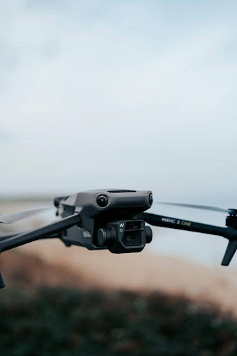
Professional Drone & Thermal Imaging Services in Surrey
GB Tech Aerial proudly delivers advanced drone and thermal imaging services across Surrey, supporting homeowners, commercial property owners, developers, engineers, and renewable energy operators. With a strong focus on accuracy, safety, and actionable insights, our surveys help clients make informed decisions while reducing costs and disruption. From detailed Thermal Imaging Building Surveys to high-resolution Aerial Photography, we provide reliable data tailored to your project.
Thermal Imaging Surveys in Surrey
Our specialist Thermal Imaging Survey services are designed to identify hidden issues that are often invisible to the naked eye. Using industry-leading sensors, we carry out professional Thermographic Survey and Thermography Inspection solutions for both residential and commercial properties across Surrey.
What sets us apart is the quality and depth of our reporting. We provide in-depth thermal imaging reports written by qualified engineers and surveyors. Each report goes beyond imagery alone, breaking down every identified issue using a clear Recommended Priority Level (RPL). Findings are fully documented with defect identification, cause analysis, and practical repair recommendations, giving you a clear, actionable understanding of the building’s condition.
A Home Thermal Imaging Survey is ideal for homeowners looking to improve energy efficiency, locate heat loss, or identify moisture ingress. Through Infrared Thermographic Inspection, we can detect insulation defects, cold bridging, air leakage, and damp-related problems without invasive investigation, all supported by detailed technical commentary.
For larger sites, our Thermal Imaging Building Surveys provide valuable insight into the performance of the building fabric. These surveys are commonly used for condition assessments, pre-purchase reports, and ongoing asset management. We also offer specialist Thermal Imaging Leak Detection, helping pinpoint leaks in flat roofs, pipework, and building envelopes, supported by engineer-led analysis and prioritised recommendations.
Roof Inspections & Building Surveys Using Drones
Traditional roof access can be costly, disruptive, and potentially dangerous. GB Tech Aerial provides safe and efficient Drone Roof Inspection and Drone Roof Survey services throughout Surrey. By using high-resolution cameras and thermal sensors, we deliver detailed visual and thermal data without the need for scaffolding or cherry pickers.
Our Commercial Roof Inspection and Thermal Roof Inspection services are ideal for warehouses, offices, schools, and industrial units. Thermal data allows us to identify trapped moisture, insulation failure, and heat loss, while visual imagery highlights defects such as cracks, membrane damage, and blocked drainage.
We also undertake comprehensive Drone Building Inspection and Building Envelope Survey projects. These inspections assess roofs, façades, cladding, and external elements, supporting maintenance planning, defect analysis, and compliance reporting. An Aerial Roof Survey provides a clear overview of roof condition, even on complex or hard-to-access structures.
Renewable Energy & Infrastructure Inspections
Surrey is home to a growing number of renewable energy assets, and GB Tech Aerial supports their efficient operation with specialist drone inspections. Our Wind Turbine Drone Inspection services provide a safe alternative to rope access or shutdown-heavy inspections. By using drones for wind turbine inspections, we can capture detailed, close-up imagery of blades, hubs, and towers while reducing both downtime and risk.
For solar installations, we offer Solar Farm Drone Inspection and Drone Thermography Solar services across Surrey. A Solar Panel Thermal Inspection identifies underperforming panels, faulty cells, and connection issues by detecting abnormal heat signatures. These surveys help maximise output, reduce maintenance costs, and extend the lifespan of solar assets.

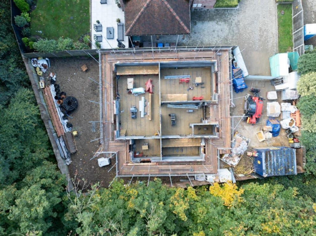
Aerial Photography, Mapping & 3D Data
In addition to inspection services, GB Tech Aerial provides professional Aerial Photography and Drone Photography for marketing, planning, and documentation purposes. Our imagery is ideal for construction progress reports, property promotion, land assessments, and stakeholder presentations.
For more technical projects, we offer Drone 3D Mapping and Drone Mapping solutions. Using photogrammetry, we generate accurate 2D orthomosaics and 3D models suitable for surveying, volume calculations, site planning, and asset management. These datasets provide a clear, measurable overview of sites across Surrey, from small developments to large commercial estates.
Why Choose GB Tech Aerial in Surrey?
Choosing GB Tech Aerial means working with an experienced, fully insured, and CAA-compliant drone operator. We combine advanced drone technology with professional reporting to deliver results you can trust. Every Thermographic Survey, roof inspection, or mapping project is tailored to your specific requirements, ensuring you receive clear, practical insights rather than just images.
Our local knowledge of Surrey allows us to operate efficiently while understanding the varied building styles, commercial environments, and rural landscapes across the county. Whether you require a Thermal Imaging Survey for a residential property, a complex Building Envelope Survey, or large-scale renewable energy inspection, our team is ready to help.
Drone & Thermal Imaging Services Across Surrey
GB Tech Aerial supports clients throughout Surrey, including urban centres, business parks, industrial estates, and rural locations. Our flexible approach means we can support one-off inspections or ongoing survey programmes, always delivering high-quality data with minimal disruption.If you are looking for reliable drone inspections, professional thermal imaging, or advanced mapping services in Surrey, contact GB Tech Aerial today. We will be happy to discuss your project and recommend the most effective solution for your needs.